Update of the Biological Valuation Map and Natura 2000 habitat map
A new 2025 edition of the Biological Valuation Map (BVM) and the Natura 2000 habitat map is now available. This is not a completely new map: since the 2023 edition, we have remapped 48,000 hectares of open space through site surveys, both in agricultural areas and in areas of high natural value. In addition, approximately 37,000 hectares in agricultural and built-up areas were updated on the basis of recent aerial photographs and other sources, such as the agricultural declaration map, without site inspections.
We were able to carry out some of the site surveys outside the special protection zone (9,500 hectares) with the support of the European LIFE project B4B.
Especially outside the special protection zones, both new editions still consist largely of data from before 2010. When using the maps, it is therefore important to always take into account the year of the original mapping.
Biological valuation map
The BVM is an area-wide inventory and evaluation of the entire Flemish Region. The inventory includes land cover (buildings, marshes, forests, etc.) and vegetation (dry heathland, reed marshes, oak-birch forests, etc.). We also pay attention to small landscape elements (pools, rows of trees, hedgerows, etc.). Colouring in shades of green indicates the biological value and gives the user a quick impression of the natural value of an area.
Natura 2000 habitat map
The Natura 2000 habitat map provides information about the distribution and surface area of European protected habitat types. Biotopes of regional importance in Flanders are also included in this map. These are biotopes that are not on the European Habitat Directive, but are comparable in terms of biological value and importance for biodiversity and are protected in Flanders under the Nature and/or Forestry Decree.
The new edition of both maps is freely available:
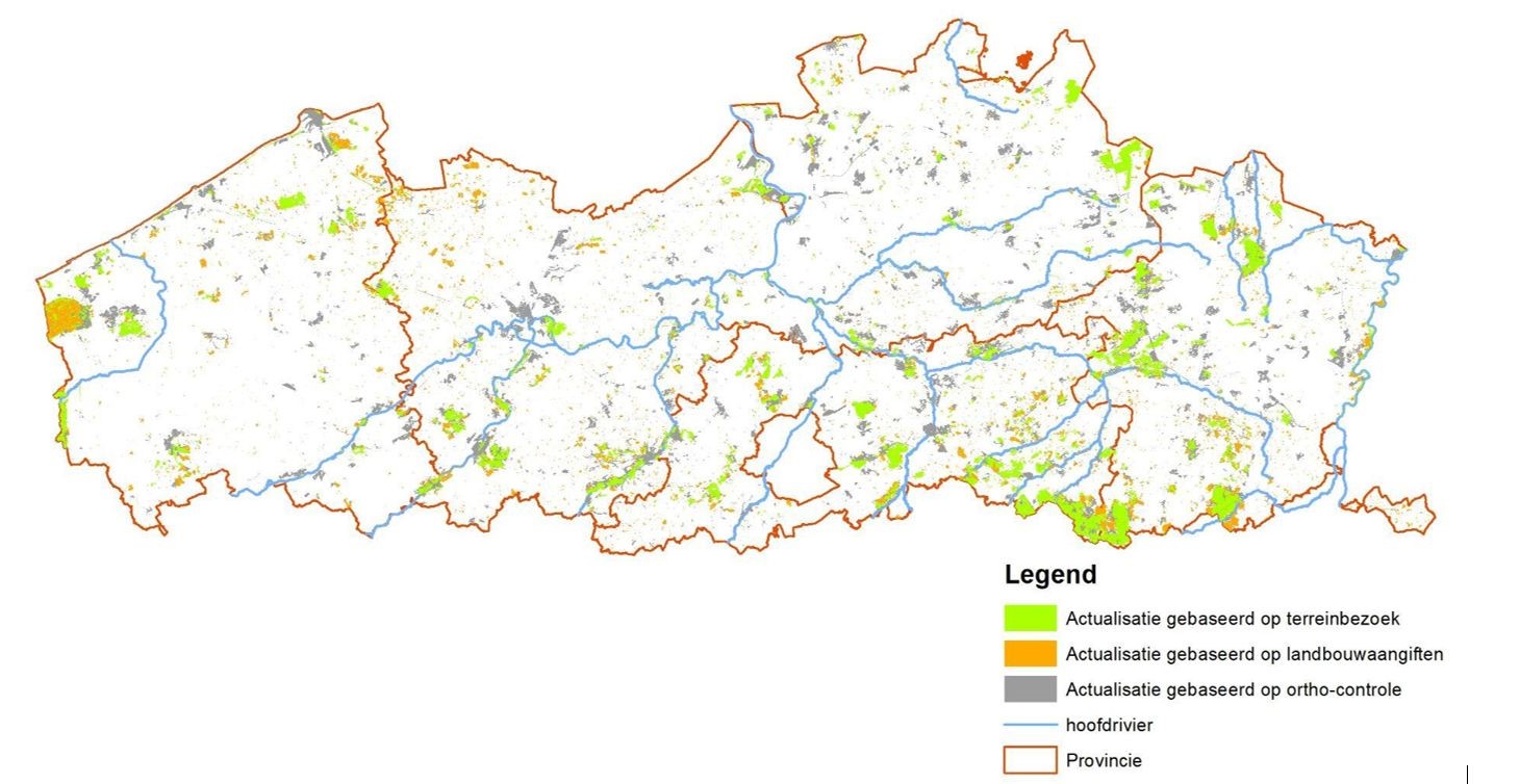
Location and spatial distribution of adjustments to the BVM and habitat map since publication in 2023. A distinction is made between adjustments based on site visits, adjustments based on checking recent aerial photographs, and consultation of agricultural parcels.
Adjustments based on aerial photographs mainly relate to the expansion of urban areas, while adjustments based on agricultural parcels relate to updates of the area of arable land, low-stem fruit orchards and temporary grassland.
Adjustments based on aerial photographs mainly relate to the expansion of urban areas, while adjustments based on agricultural parcels relate to updates of the area of arable land, low-stem fruit orchards and temporary grassland.