Machine learning digitization of historical land use
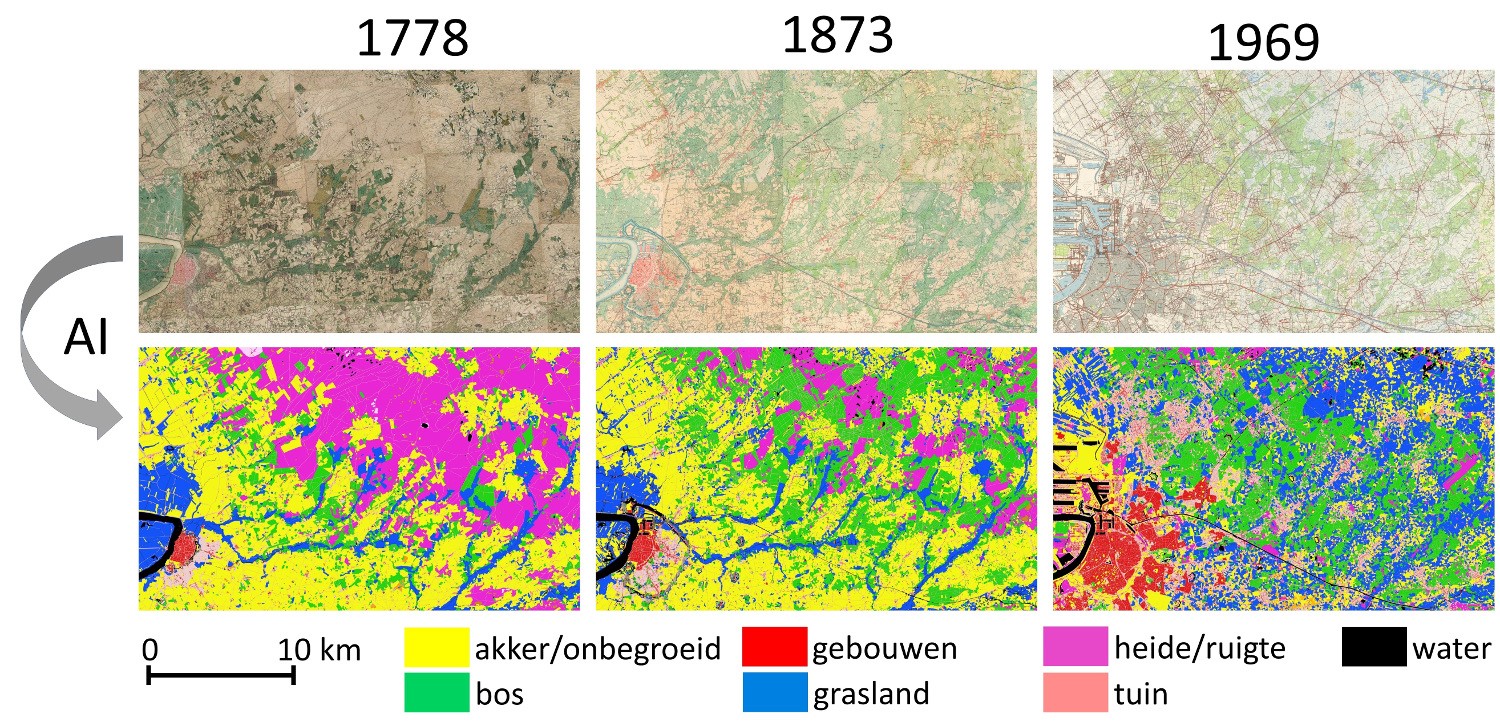
Historic land use Antwerp area (image INBO)
Details
Machine learning techniques and the availability of georeferenced historical maps offer new opportunities to digitize historical land use. A cooperation between several Flemish authorities (INBO, department of agriculture and fisheries, Digital Flanders, VITO) aimed to do so for 3 or 4 historical maps, and analyse land use changes for a time span of approximately 200 years.| Status | Running |
|---|---|
| Actual start/end date | 01/04/2022 - 31/12/2026 |
Teams
INBO Research theme(s)
- Soil & air
- Nature & society
Tags
- historicalmaps
- landusechanges
- landusechanges