Long-term ECODYN assessment assures balance between nature management and flood protection in Common Meuse
The Common Meuse is an important area in Flanders for achieving European habitat targets for softwood and hardwood riparian forests, among others. However, the development of these habitats may cause coarsening of the winter bed with consequences for flood safety. The Agency for Nature and Forest (ANB) asked us to calculate a long-term forecast of ecotope development on the Common Meuse for the long-term management working group of the Flemish-Dutch Bilateral Meuse Commission (VNBM). For this type of prediction, we use the ECODYN model developed at INBO.
ECODYN stands for 'ecological dynamics', it is an ecotope prediction model of a river system prepared within the integrated research approach of the Common Meuse project. It brings together the three driving river dynamics elements: morphology, flow and management. In ECODYN, a number of ecological processes are modelled and integrated into a spatially predictive model. On this basis, we estimate the settlement and survival rates of species and populations.
The ECODYN predictions in this study show that grazing management combined with targeted management of riparian forests can guarantee flood safety as well as meeting European nature targets. The next step is to work with nature and river managers and stakeholders to determine the right approach on an area-specific basis, for which a decision support tool, Interreg EMfloodResilience, is being developed.
Alexander Van Braeckel & Merlijn Jocque
Read the report (in Dutch, with English abstract): Van Braeckel A. & Jocque M. (2023). Ecologische effecten van ingrepen en beheer op Europese natuurdoelen: Lange termijn doorrekening Grensmaas met ECODYN. Rapporten van het Instituut voor Natuur- en Bosonderzoek 2023 (7). Instituut voor Natuur- en Bosonderzoek, Brussel. DOI: doi.org/10.21436/inbor.91190882
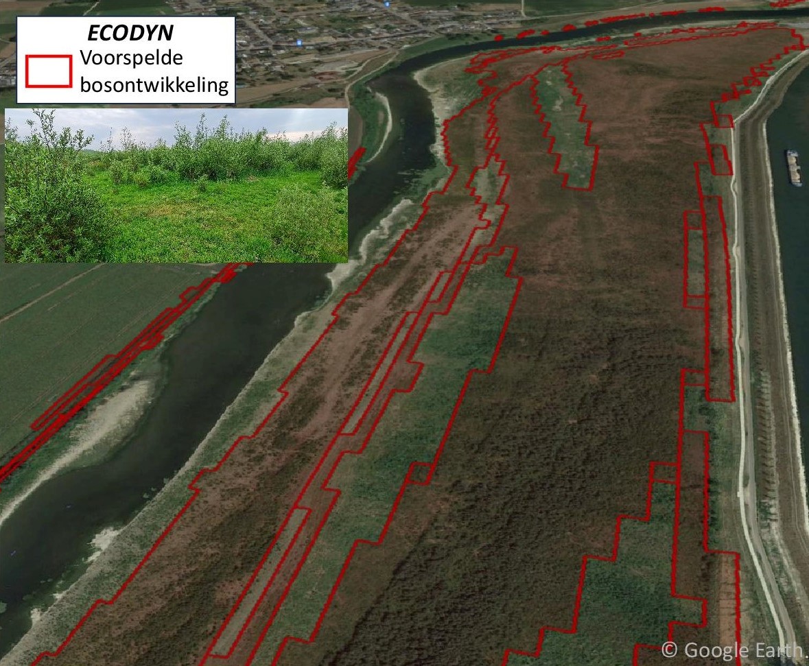
Prediction of forest development after 10 years after excavation of a project area along the Common Meuse. In the background the forest development on the aerial photo (google-earth) and a photo on the site
Image above: forest development (INBO photo)