EMFloodResilience: Mapping the impact of the summer flood 2021 along the river Meuse to optimise future river management and policy
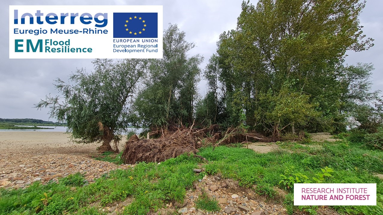
The Meuse two months after the July 2021 floods: cracked trees and large-scale deposits of sand and gravel (photo INBO)
Details
Interreg Euregio Meuse-Rhine in a 'post-high water' contextInterreg Euregio Meuse-Rhine (EMR) sponsors projects with partners across borders. They invest in projects around innovation, economy, social inclusion and training and territorial cohesion. By stimulating cross-border cooperation, they strengthen economic and social cooperation in the border zone between Belgium, Germany and the Netherlands. The Interreg V-A EMR program is investing almost 100 million euros in the development of this Interreg area in the period until 2023.
A total of 6.9 million euros will be invested in the Interreg project EMFloodResilience. Within this, the various partners will be able to carry out projects with the following focus: improving weather and flood forecasting, strengthening crisis response, and making spatial planning more climate resilient.
EMFloodResilience: Eleven partners work together internationally against flood impacts
Following the 2021 flood event in Belgium, Germany and the Netherlands, 11 partners from the three countries decided to join forces to reduce flooding and improve flood safety. The climate is changing and extreme weather situations will unfortunately become more frequent. Therefore, we are investing to warn the population about the risks of flooding.
The goal of the EMfloodResilience project is to exchange information euregionally and improve cooperation between public river authorities. The main goal is for the EMR region to benefit from improved methodology during major crisis situations to analyze intervention effects and their impact on the EMR and its citizens. The ultimate goal is to be better prepared during new extreme flood events and prevent future damage to life, and socio-economic damage.
More information in English about this project can be found on the interregwebsite: www.EMFloodResilience.eu (web link at the bottom of the web page)
This cross-border project is possible thanks to the contribution of the Interreg program totaling 6.9 million euros. Project proposals for all aspects have been submitted and approved by the Interreg program authority for an amount of more than 8 million euros. The projects will run until December 31, 2023.
INBO as project partner
In cooperation with numerous partners, INBO are conducting research into the consequences of the summer high water of 2021 along the Grensmaas. Together with the Meuse-in-Beeld team, we are mapping the consequences of the extreme high water on the terrestrial and aquatic river ecosystem of the Meuse.
We are also developing a tool to optimize coordination with nature in future decisions on flood safety. We will develop a prototype of a Decision Support System (DSS) model that provides policy-supporting map layers. In doing so, we will use the ecosystem model ECODYN developed by INBO. This will contribute to a more balanced policy on nature and flood protection in which both European nature goals and flood protection goals can be achieved.
The project partners are
1. Limburg Water Board (project leader)
2. Rijkswaterstaat
3. KNMI
4. Delft University of Technology
5. Municipality of Weert
6. University of Liege
7. Province of Liège (BE)
8. De Vlaamse Waterweg
9. The Research Institute for Nature and Forest (INBO).
10. Eifel Rur Water Association
11. RWTH Aachen University
The Service Public Wallonie (SPW) is an associated partner within this project.
The EMfloodResilience project is being carried out within the context of Interreg V-A Euregio MeuseRhine and is 90% funded by the European Regional Development Fund
>> To the EMFloodResilience.eu website
| Status | Uitgevoerd |
|---|---|
| Actual start/end date | 01/09/2022 - 31/12/2023 |
Teams
INBO Research theme(s)
- Protected nature
- Water
- Climate
Tags
- EVINBO
- Natura2000
- wetlands
- valley
- climate
- EVINBO
- Natura2000
- climate
- evinbo
- natura2000
- natura2000
Participants
Olja BezdenjesnjiLinde Galle
Isabel Lambeens
Vincent Smeekens
Thomas Terrie
Alexander Van Braeckel
Gunther Van Ryckegem
Hugo Verreycken
Merlijn Jocque
Erika Van den Bergh